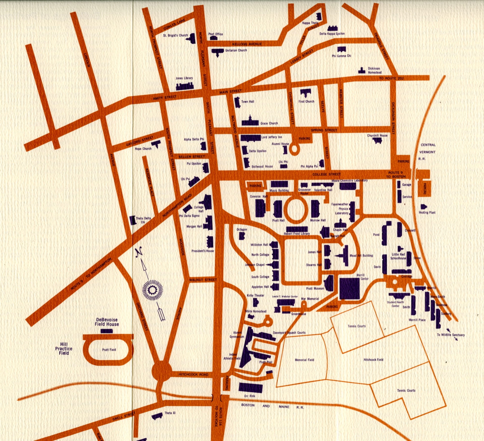
The first time I stepped foot on Amherst campus, I became horrendously lost. I desperately looked for a building sign, an arrow to point me in any direction, or even a human (gasp!) to ask directions from. Standing outside, in the freezing cold experiencing my first winter storm, I found none of these things.
There are no signs signaling the front of buildings, the back of buildings, or even the names of buildings. There is an air of pompousness, of know-how — why, of course that’s Johnson Chapel! What other building could that be? But to me, a person who struggles with spatial dyslexia, signs are everything.
So for my first post as a racial history intern, I wanted to focus on space, land, geography. The question that I so often ask myself, “Where am I?” I want to ask in a less rhetorical way, and ask this question in an attempt for answers rooted in historical memory.
This blog post will not be a pretty, tied up together sequence of information dumping. Rather, I formatted this blogpost in an organic style, so that you, the reader, can follow along with me and arrive at the same places that I did, in the same order that I did. This is an attempt to be as transparent as possible about my process, and to use layman’s terms. The information I came upon is out there and readily available, not meant to be obfuscated or hidden.
So to re-iterate, I first asked the simple question — “Where am I?” The obvious, simple answer to that is “Amherst College,” so that is where my search started; looking into the college and its name. In my search, I ended up finding this original document, which I found on the digital Amherst website, is a scan of the original petition for the college to be named “Amherst.” Amherst College is slightly unique in that it is not named after someone, like many elite colleges are. Harvard, for example, is named after Rev. John Harvard, because its original purpose was to educate clergy members (we can delve into the history of philanthropy and the naming of buildings in another blogpost). But Amherst College was simply named after the town, which itself was named after the infamous Lord Jeffrey Amherst, which can be read more about in this article titled, “The town of Amherst – what’s in a name?”.
But surely, I thought to myself as I was rapidly searching on Amherst’s website for more information about the land the school resided on, surely there is more to Amherst than Lord Jeff. More to this land than a man who wrote a letter that said, “You will do well to try to inoculate the Indians by means of blankets, as well as to try every other method that can serve to extirpate this execrable race.”
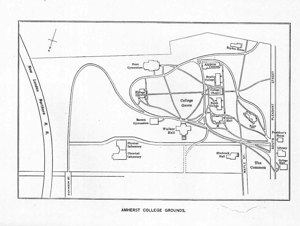
Immediately upon finding the simple answer to my original question, more questions followed. What gives land its identity? What makes Amherst — Amherst? Before there was a Johnson Chapel, or a Moge Tea, or the sprawling sports field, what was there? Or more importantly, who was there, on this very same land, before me? Before any of us? Before Lord Jeff?
To answer these plethora of questions, I dug further, coming upon the digital archives webpage entitled, “A Glimpse of Early Amherst”, in which there is a brief description on how the “early settlers” came to Amherst with specific reference to the ancestral colonizers that arrived in Hadley in 1631. While that scratched the surface, I knew that wasn’t the whole story. Were the “original settlers” that the archive was referencing the actual first people that were on Amherst land? This brief research just caused me to want to know more.
With some brief digging around on Amherst’s website, I came across Professor Lisa Brook’s webpage, The Common Pot: The Recovery of Native Space in the Northeast, which features an interactive map that highlights and features different indiginous land and waterways.
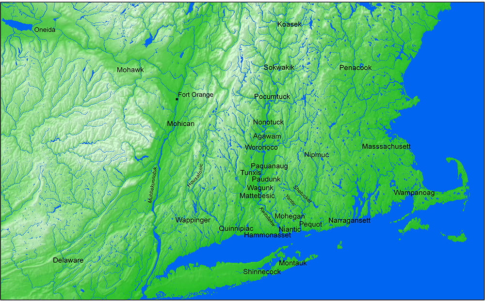
This map of Mohegan Environs shows the different Indigenous peoples that live(d) on the land. Honestly, I had to cross reference Google Maps and search “Amherst” in order to know where to look. But if one is more geography inclined than me, you would know that Amherst College is stationed on Nonotuck land.
While all of the information revealed in this blogpost may be obvious to students, alumni, or faculty who have been at Amherst for many years, all of this information was new to me. I came to Amherst College after the mascot was already “mammoths”, after the Lord Jeff’s Inn was re-named the Boltwood, and years after the Amherst Uprising. The history that is foundational to the college, information that is and “should be” so implicit to students — the history of Lord Jeff, that Amherst is on Nonotuck land, or simply what buildings are called and where they geographically are — was not at all obvious to me. Rather than learning about Amherst Uprising or the History of Lord Jeff through classes or even in passing, I had to learn this myself, through my own research. And to be quite honest, I fear the future in which students forget, or even worse, are ignorant of, the history that is foundational to Amherst College.
To use the title of Joyce Carol Oates’ “Where Are You Going, Where Have You Been?” to end this blog post, I end on a note of imploration for not only self-awareness, but awareness of others and of the space and land we occupy. For the history of Amherst College, however dark or however beautiful, to be shared without hesitation, as that is the only way that we can truly pay respect — not by hiding history, but by acknowledging it and swearing to never repeat it again.
You must be logged in to post a comment.